
Ortelius’ book of maps, first published in 1570, is considered the first modern world atlas. It was the first time that a set of maps, contemporary to the date of publication, was designed, drawn, and engraved with the intention of publishing them in a bound volume. Ortelius did not refer to his publication as an “atlas,” as we know it today. Rather he entitled it “Theater of the World,” implying not only that the entire known world could be viewed in this one book, but that the Earth was a stage on which human actions unfolded.
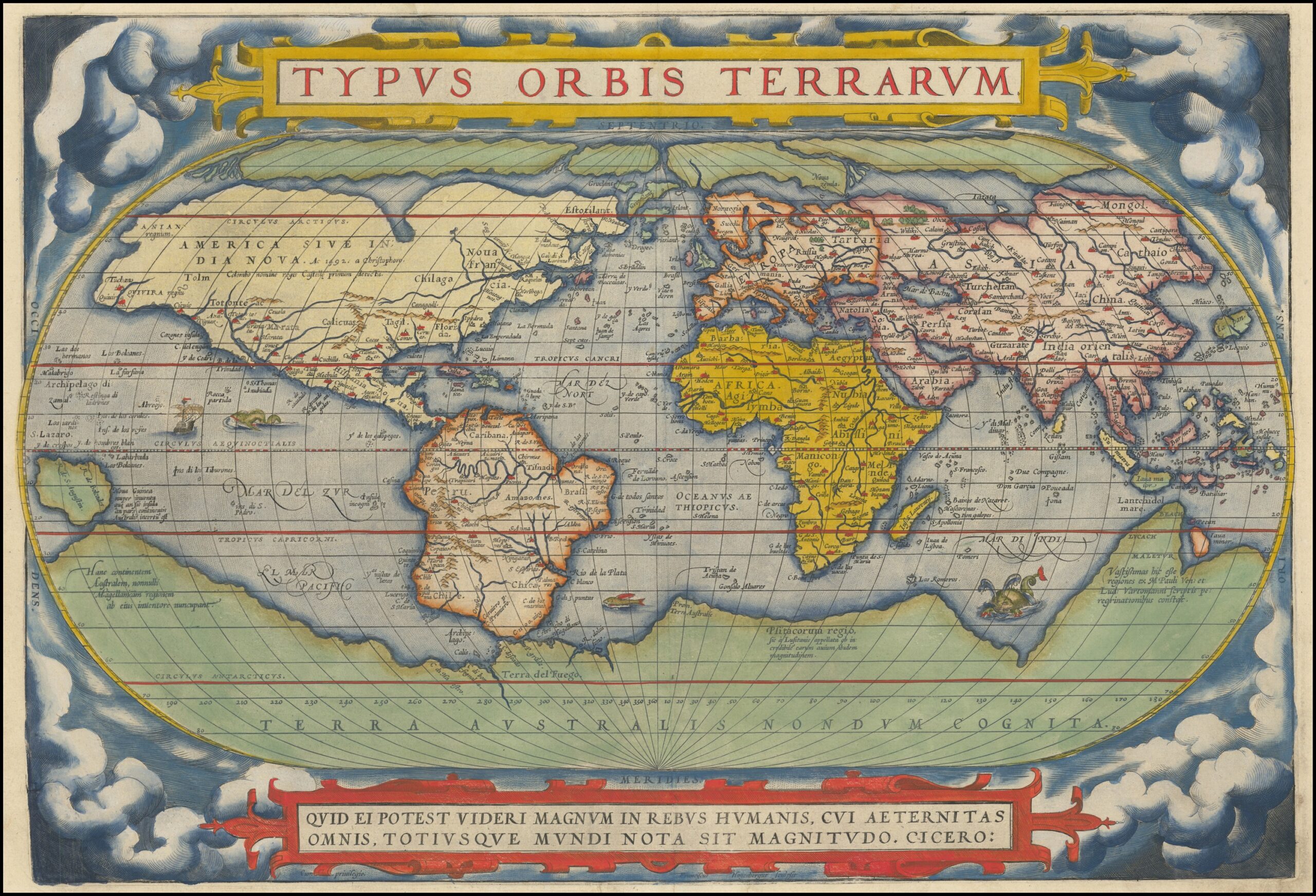
Although most of the maps in this book pertain to European countries and provinces, it can be considered a world atlas because it also includes a map of the world (displayed here), as well as one map for each of the four continents.
The featured map is from the second state and was published c.1578 and is similar to the first state map, but with a few corrections. It is one of the most recognized maps from the Age of Discovery. This version includes the mythical Great Northern Passage, an irregular “bulge” on the west side of South America and the mythical Great Southern Continent, “Terra Australis Ingognita,” roughly in the place of Antartica before its discovery. Most of North America is still based on conjecture and mythology, though he does credit Columbus for its discovery.
While the first edition of Ortelius’ ”Theatrum” was published in Latin in 1570, this book was subsequently issued in 33 editions over the next 41 years. It was also translated into six other languages – German, Dutch, French, Spanish, Italian, and English. The success of this first atlas publication marked the beginning of the Golden Age of Flemish and Dutch Cartography with cartographers from the Low Countries dominating the map trade until the end of the 17th century.