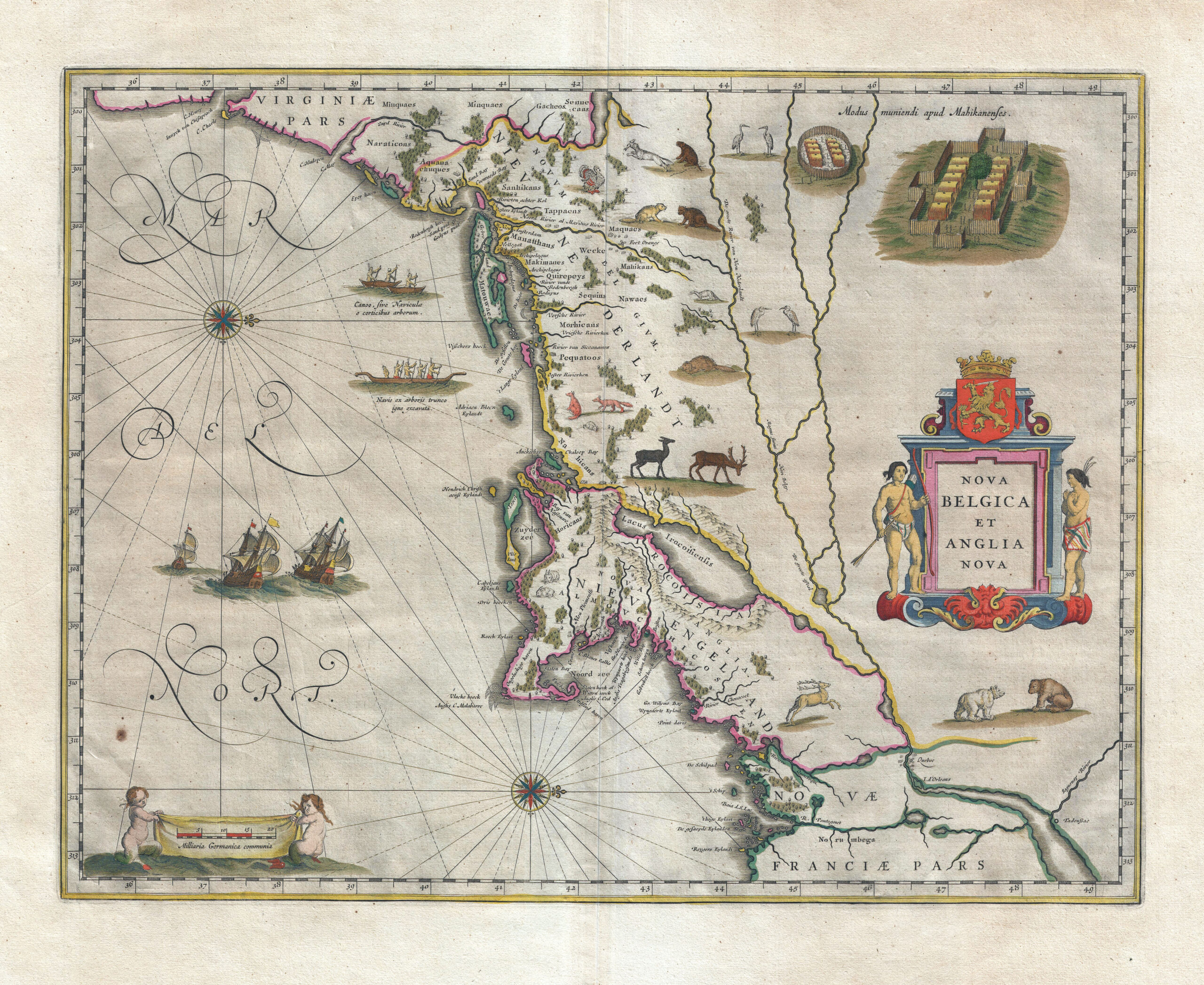
This elaborately decorated map is based on the 1614 explorations of Adrian Block, a fur trader working for the Dutch, who sailed from the north shore of Long Island to explore the southern coast of New England. William Blaeu, the premier Dutch map and globe maker of that period, published this map of New York and New England based largely on Block’s reports. Oriented with west at the top, it is the first printed map to depict details of the interior of New England, including the first printed map to depict Manhattan as an island. It is also decorated with North American motifs, including Native Americans and their villages and canoes, as well as bears, beavers, turkeys, and other fauna.
