
Early Map of the Great Lakes and the French Fur Trading Frontier
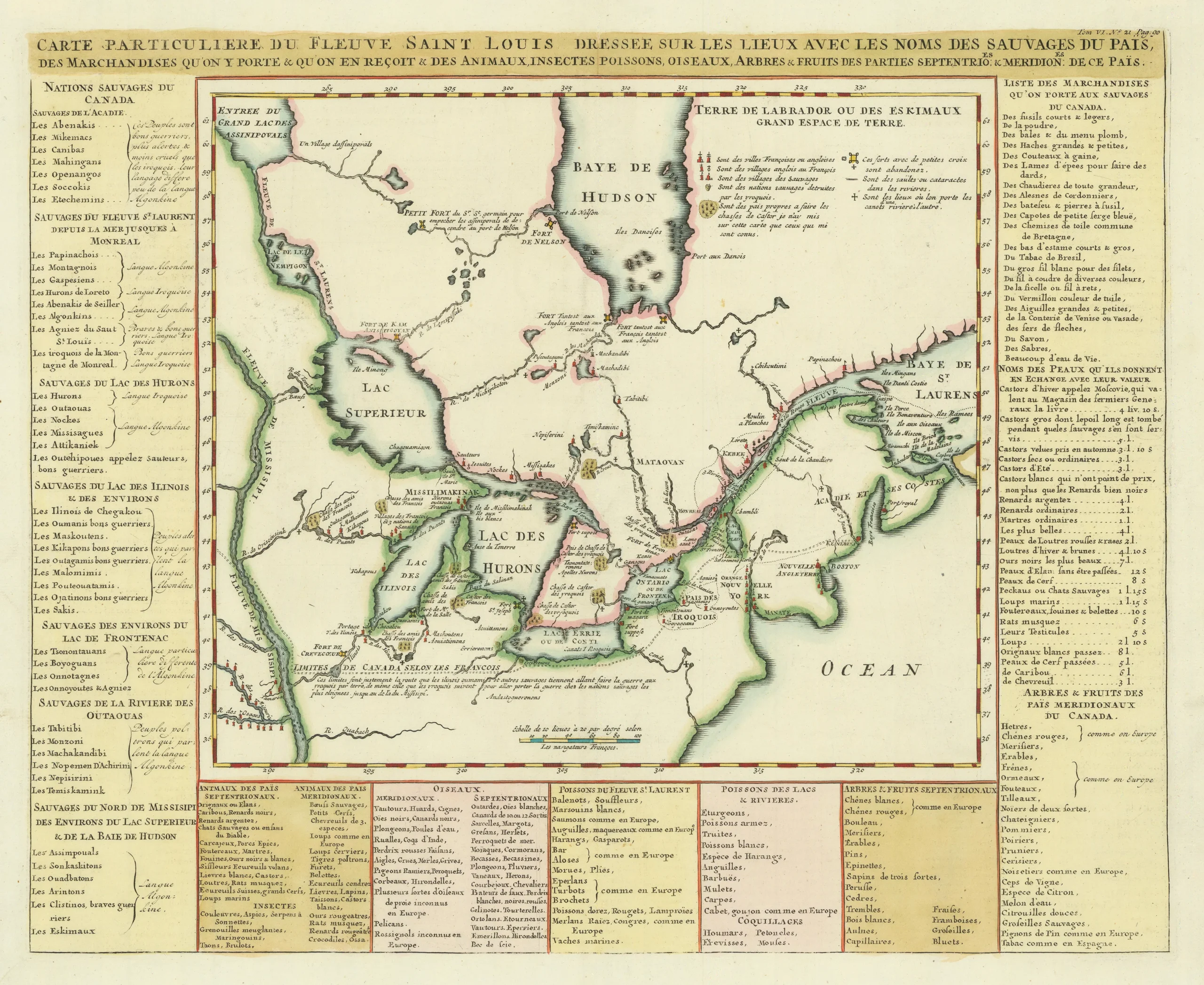
A fine example of this important early map of Canada, the Great Lakes, and the upper Mississippi River, extending south to the Missouri and Ouabache Rivers. Based on Louis Jolliet and Jacques Marquette’s 1673 expedition, it captures the earliest French exploration of the interior and the fur-trading regions of New France.
Adapted for inclusion in Thévenot’s Recueil des Voyages (Paris, 1681), this was the first printed map to show the Mississippi River and its northern tributaries from firsthand observation—along with the first appearance in print of the name Michigan (or Mitchigami).
Rich with detail, the map records French missions, forts, Indigenous settlements, portages, and trade routes, offering a vivid view of exploration in progress while the fabled “route to the Pacific” remained uncertain.
A landmark in the mapping of North America, this work stands as an essential visual record of Jolliet and Marquette’s journey and the earliest cartographic definition of the heart of the continent.