
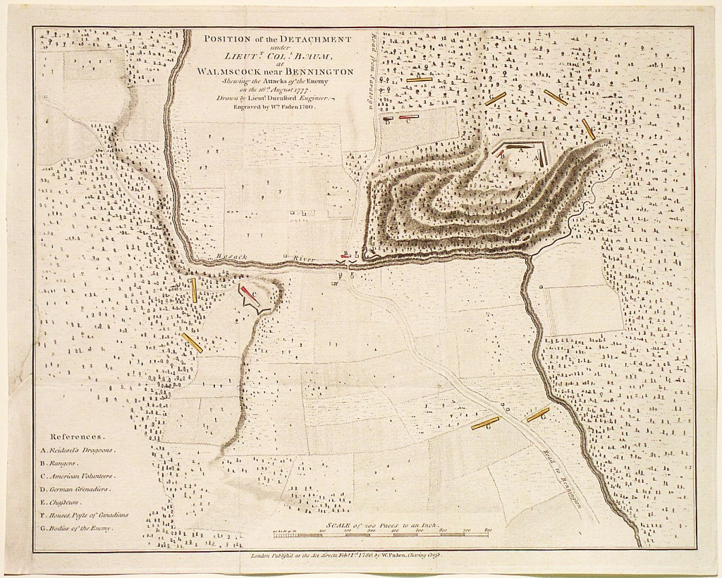
Position of the Detachment under Colonel Baum, at Waloomsack, near Bennington Shewing the Attacks of the Enemy on the 16th August 1777. Drawn by Lieut. Durnford, Engineer. Mapmaker: Faden, 1780
This is the rare separately-issued version of William Faden’s plan of the Battle of Bennington. My ancestor, Moses Nichols, was a colonel in the New Hampshire militia and was a leading force in this battle. The position of his troops is shown on the map (red dot). Nichols’ troops fired the first shot in this battle that resulted in the decisive defeat of the British and pre-saged the defeat at Saratoga just weeks later. Saratoga is often called “the turning point” of the Revolutionary War and is listed as one of the top battle campaigns of all time.
Faden’s series of battle plans is the most important for the Revolution. The plans are generally based on notes and sketches made on the field of battle by British engineers. Included in the series are plans for battles for which no other printed cartographic record exists, as with this example.
The Battle of Bennington actually took place about ten miles west of that town, near Walloomsac at a crossing of the Hoosack River, Rensselaer County, New York. An American force, including members of Seth Warner’s famous Green Mountain Boys, decisively defeated a detachment of General John Burgoyne’s army led by Colonel Friedrick Baum. Nebenzahl says that Bennington was “of great significance … a major British failure.”
The British force had been sent to raid Bennington for horse, pack animals and other supplies. They were unaware of the sizable American force stationed there. The battle was a decisive victory for the Americans, as it reduced Burgoyne’s army by nearly one thousand men, led his Indian allies to largely abandon him, and deprived him of needed supplies. The map shows the positions of the British and American forces, the road from Saratoga and the road to Bennington, and shows the area’s topography in excellent detail.