
A French Spy Map of the Mississippi River, between the Missouri River/Illinois River and Kaskaskia

An important early map, with a fascinating history, showing the confluence of the Mississippi River, with the Missouri River, Illinois River and Kaskaskia River, from the explorations of General Georges Collot. Collot’s map of the Mississippi River was compiled from his observations during his clandestine reconnaissance of the West on behalf of the French Government […]
Jolliet & Marquette’s Discoveries (c.1681)
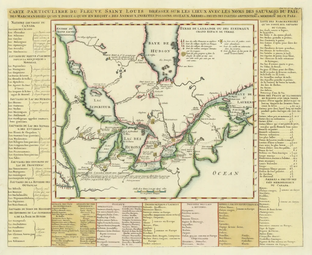
Early Map of the Great Lakes and the French Fur Trading Frontier A fine example of this important early map of Canada, the Great Lakes, and the upper Mississippi River, extending south to the Missouri and Ouabache Rivers. Based on Louis Jolliet and Jacques Marquette’s 1673 expedition, it captures the earliest French exploration of the […]
The First Map of the Mississippi River
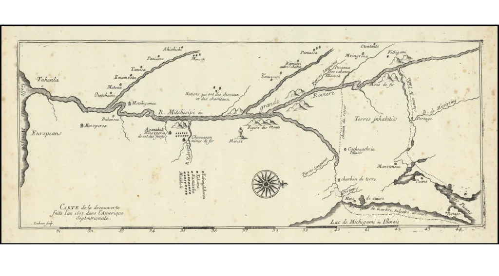
Based on the Discoveries of Jolliet and Marquette This late 19th- or early 20th-century facsimile of Melchisedech Thévenot’s 1681 map reproduces the earliest printed depiction of the Mississippi River, based on the 1673 expedition of Louis Jolliet and Father Jacques Marquette. It represents the first separate map to illustrate their journey down the Mississippi—one of […]
Lewis & Clark’s Map of Western Discovery (1814/1815 London Edition)
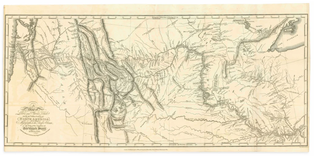
The Single Most Important American Exploration Map of the 19th Century This 1815 London octavo edition of Lewis and Clark’s official expedition account includes the famed folding map of the Northwestern United States, based on William Clark’s original manuscript. It provided the first accurate depiction of the sources of the Missouri and Columbia Rivers and […]
Nova Belgica et Anglia Nova – Johannes Blaeu, 1662
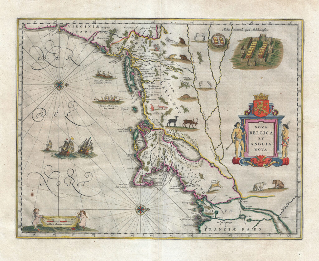
This elaborately decorated map is based on the 1614 explorations of Adrian Block, a fur trader working for the Dutch, who sailed from the north shore of Long Island to explore the southern coast of New England. William Blaeu, the premier Dutch map and globe maker of that period, published this map of New York […]