
Novi Belgii Novaeque Angliae Nec Non Partis Virginiae Tabula – Nicholas Visscher, ca. 1652
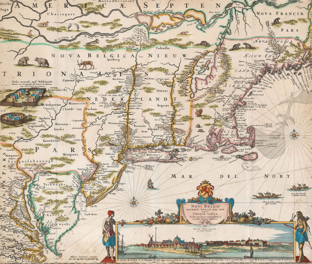
This is the scarce second state of Visscher’s New Netherlands, with Fort Kasimir included but Philadelphia still lacking. Most surviving copies are in the later third state (after 1683,) with Philadelphia added. Shortly after the first appearance of Jansson’s landmark map of New England in 1650, Nicholas Visscher issued a corrected copy, with one particular […]
Map of the City of New York, with the latest improvements – H. Phelps, 1831
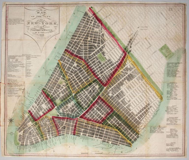
Superb Example of an Early New York City Plan Showing the Beginnings of Development Within the Grid New York City. PHELPS, H. [New York, 1831] Map of the City of New York, with the latest improvements…. This is a first edition of this very scarce, beautifully preserved plan published at the beginning of the most […]
Battle of Bennington, 1777
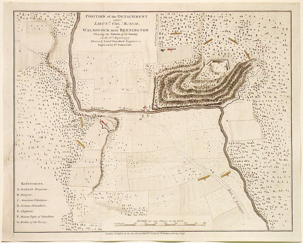
Position of the Detachment under Colonel Baum, at Waloomsack, near Bennington Shewing the Attacks of the Enemy on the 16th August 1777. Drawn by Lieut. Durnford, Engineer. Mapmaker: Faden, 1780 This is the rare separately-issued version of William Faden’s plan of the Battle of Bennington. My ancestor, Moses Nichols, was a colonel in the […]
A Map of the Most Inhabited Part of New England – Tobias Conrad Lotter, 1776
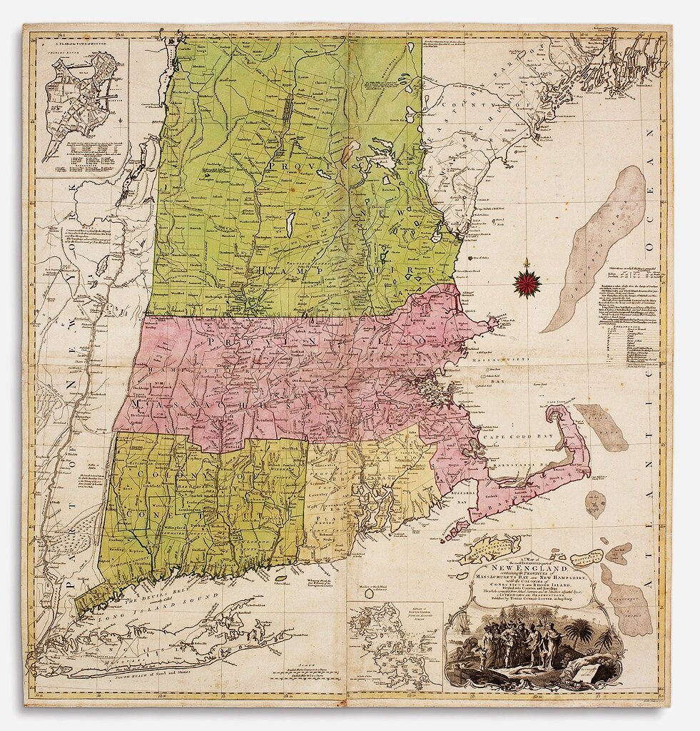
The German edition of “the first detailed large-scaled map of New England and one of the earliest printed maps of Connecticut” (Goss). “The most detailed and informative pre-revolutionary map of New England … Not really supplanted until the nineteenth century” (New England prospect, 13). The German edition follows the 1774 London edition in virtually all […]