
City View of Sevilla – Braun and Hogenberg, 1572
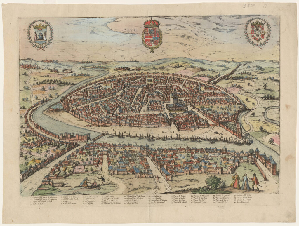
The first volume of the Civitates Orbis Terrarum was published in Cologne in 1572. The sixth and the final volume appeared in 1617. This great city atlas, edited by Georg Braun and largely engraved by Franz Hogenberg, eventually contained 546 prospects, bird’s-eye views and map views of cities from all over the world. Braun (1541-1622), […]
Panoramic View of Sevilla, Spain – Jean Boisseau, 1643
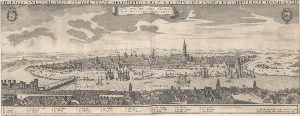
This very rare and striking panoramic view of the city of Seville depicts the city from the west bank of the Guadalquivir River. A number of locations are identified in a numbered key below the view. The city’s coat of arms is at top right, with the Royal coat of arms of Spain at top […]
Madrid Map – Society for the Diffusion of Useful Knowledge, 1833
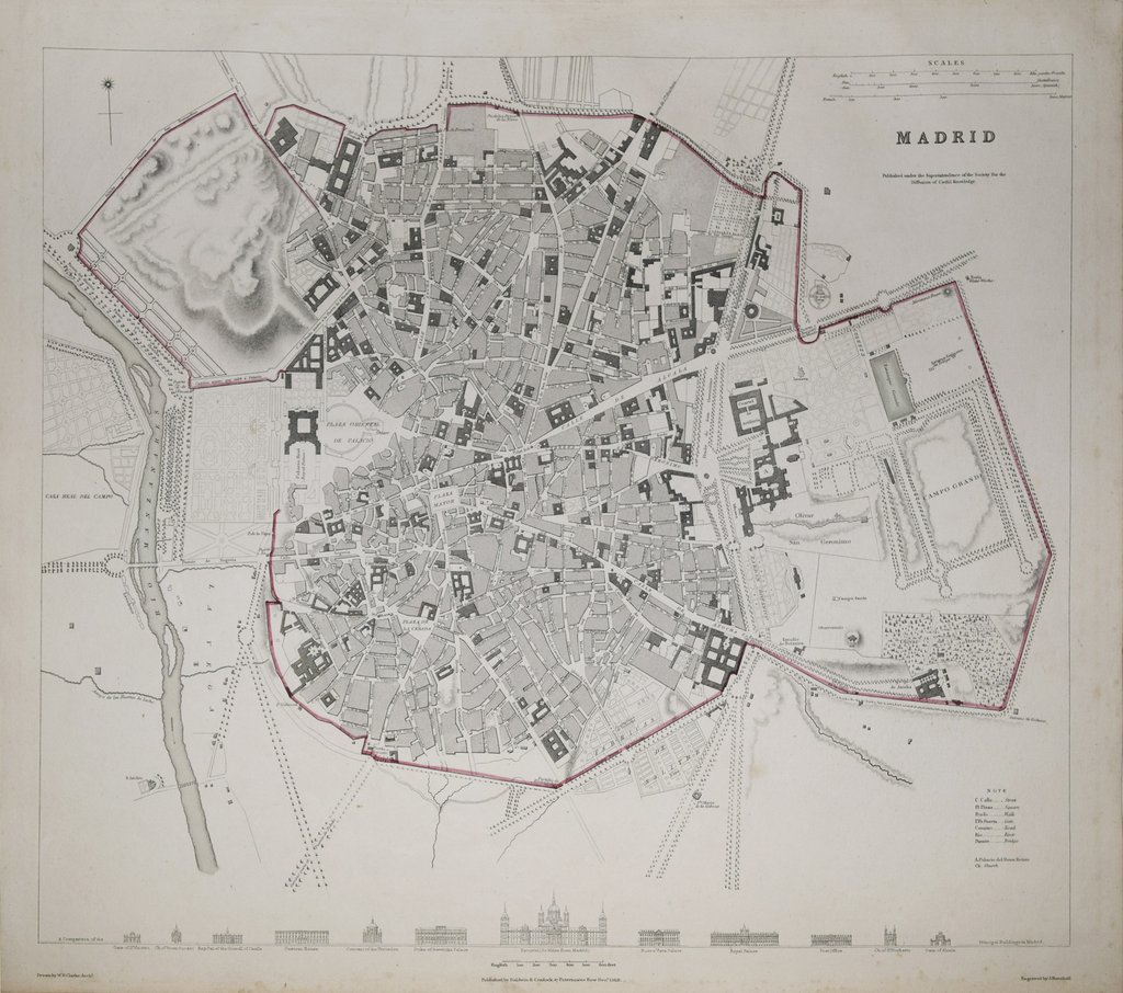
This is a top-down view of Madrid from 1833 published in Maps of the Society for the Diffusion of Useful Knowledge. Drawn by W. B. Clark, Engr. & printed by J. Henshall. Published, Baldwin & Cradock, London, 1833
Grundtriss der Edlen Weitberumbten Statt Hamburg Anno 1651 – Johannes Mejer and Caspar Danckwerth, 1652
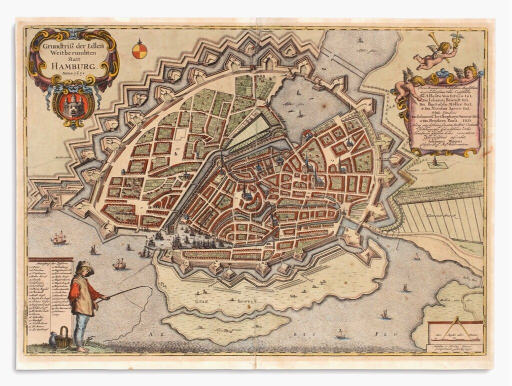
I purchased this map of Hamburg to commemorate our visit to the beautiful city of Hamburg for the International Map Collectors Society (IMCoS) Annual Symposium in October 2017.
A beautiful hand colored map of Damascus, Syria 1575
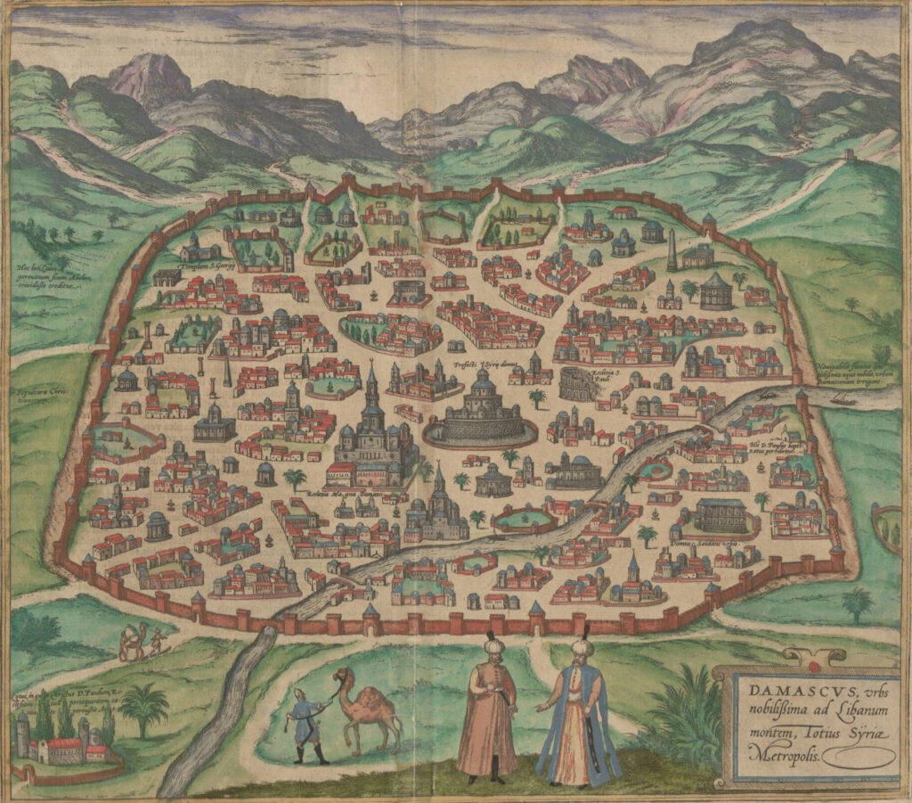
Damascus, urbs noblissima ad Libanum montem, Totius Sÿriae Metropolis This is a superb example of the 1575 view of Damascus, produced by Braun and Hogenberg for inclusion in the second volume of their Civitates Orbis Terrarum, the first dedicated city book. The beautifully engraved view, illuminated with superb original color, is one of the earliest […]
A Plan of London and its Environs, 1840
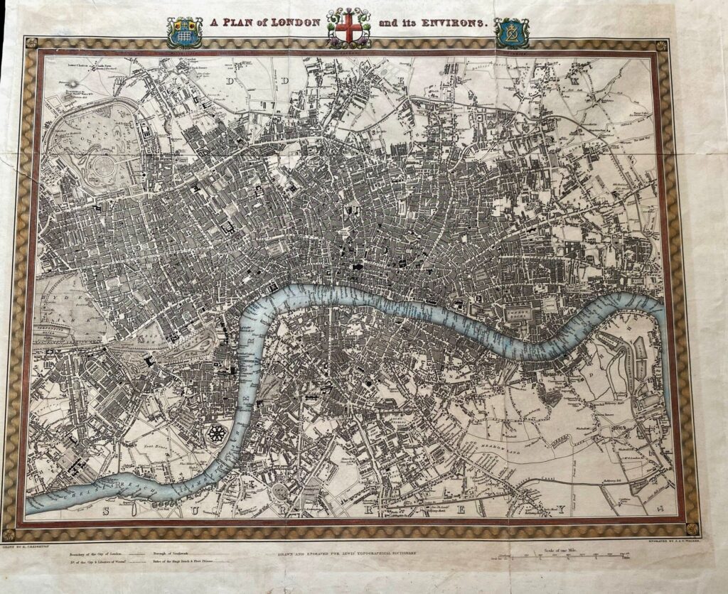
Engraved folding map from Samuel Lewis’s Topographical Dictionary. 17×21 inches sheet size; hand-colored; light soiling, few small closed tears and folds reinforced on verso.
The City of New York, 1939
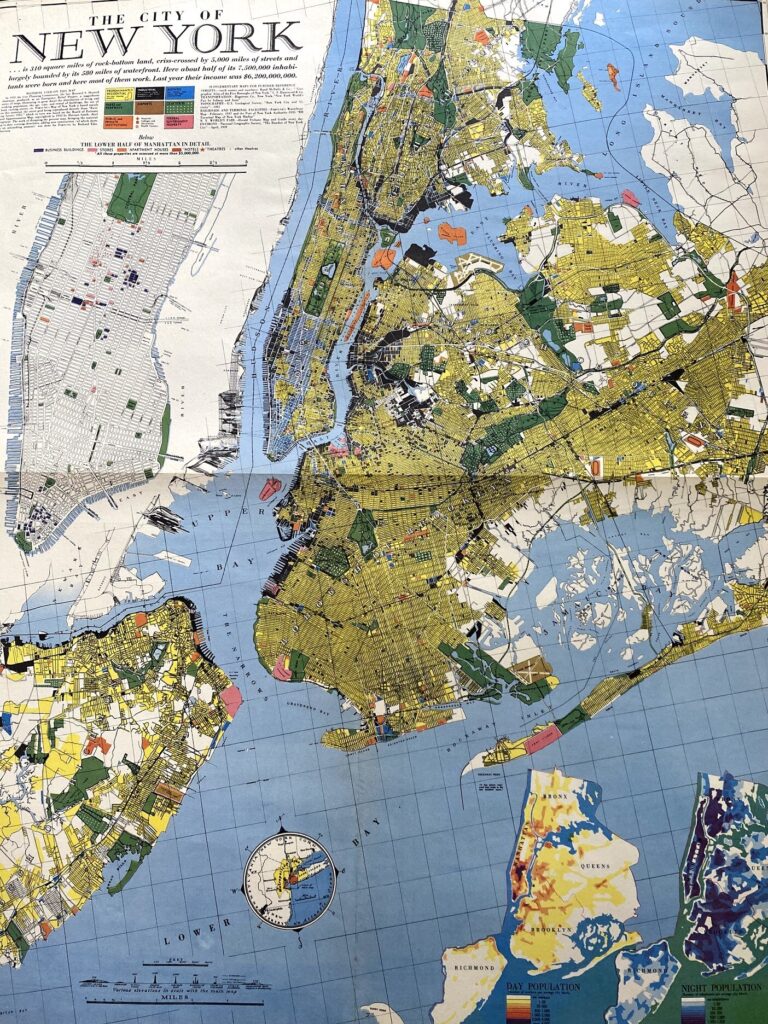
This 1939 Richard Edes Harrison map of New York City – published in conjunction with the New York World’s Fair – represents a triumph of the visual display of quantitative information. Its aesthetic impact is all the more impressive in its clear expression of municipal and demographic data, making this a map of the people […]
Vintage Map of Madrid, date unspecified
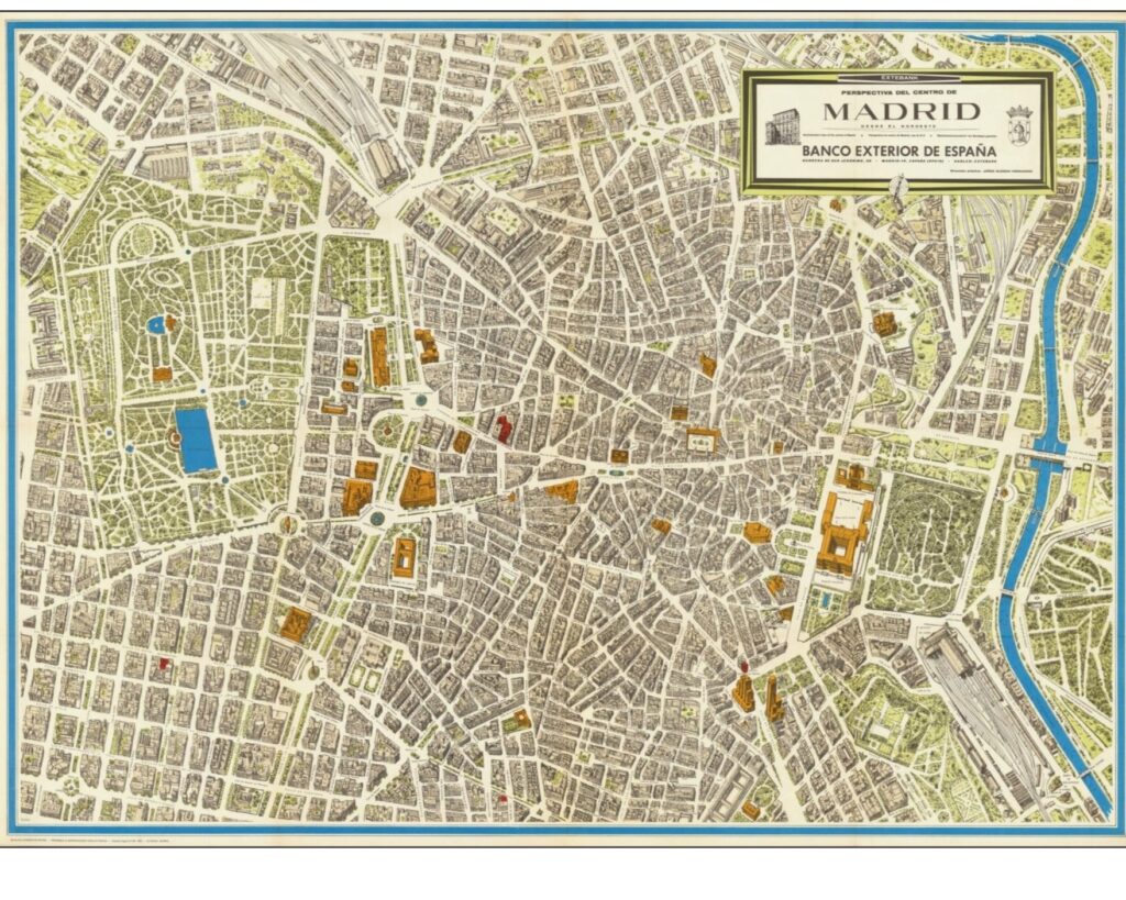
Interesting and rare map of Madrid, published for the Banco Exterior de España. This large isometric view is in the vein of Turgot, Blondel La Rougery, and Bollman. Jorge Guzman Hernandez also produced a map of Madrid.
Plano de Madrid – Francisco Coello de Portugal y Quesada, 1849
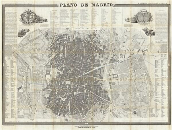
A fine example of Francisco Coello de Portugal y Quesada’s massive map of Madrid, Spain. Coello’s map is one of the finest and largest maps of Madrid to appear in the 19th century. Centered on the Puerta del Sol, this map covers the center of modern Madrid as well as the surrounding parks, farms, and […]
Bollmann’s Pictorial Map of New York – Herman Bollmann, 1963
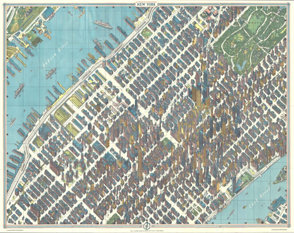
One of the greatest cartographic feats of all time, this 1963 axonometric (‘bird’s eye view’) map of New York City was the first such since 1866. The technique dates back to the 15th century, and developed in Germany into a fully flowered cartographic art form called Vogelschaukarten in Germany in the 1800s. This particular map […]