
City View of Sevilla – Braun and Hogenberg, 1572
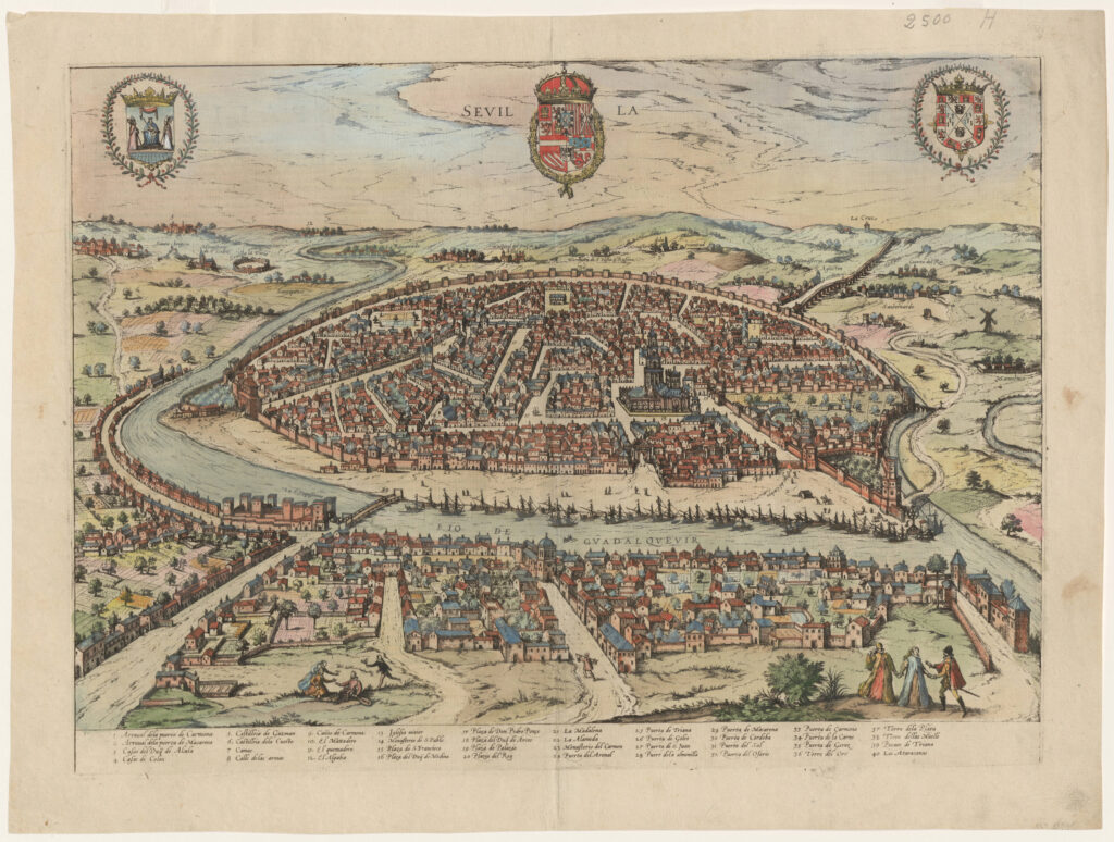
The first volume of the Civitates Orbis Terrarum was published in Cologne in 1572. The sixth and the final volume appeared in 1617. This great city atlas, edited by Georg Braun and largely engraved by Franz Hogenberg, eventually contained 546 prospects, bird’s-eye views and map views of cities from all over the world. Braun (1541-1622), […]
Map of Spain with Decorative Cartouche – Herman Moll, c. 1755
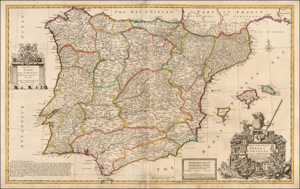
Splendid map of the whole Iberian peninsula and the Balearic islands, with an amusing note berating the publishers of other “inaccurate” maps “put out by Ignorant Pretenders.” The map includes a huge amount of information including roads, bridges and the “places where battles &c. have been fought by the English mentioned in history.” The huge […]
Panoramic View of Sevilla, Spain – Jean Boisseau, 1643
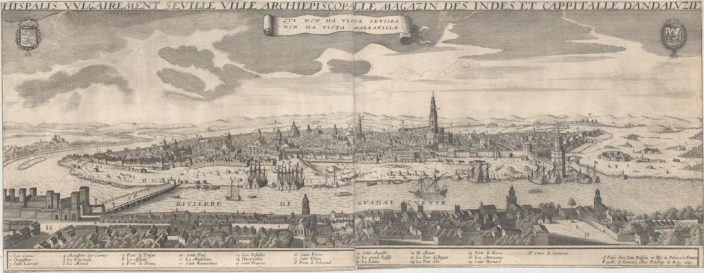
This very rare and striking panoramic view of the city of Seville depicts the city from the west bank of the Guadalquivir River. A number of locations are identified in a numbered key below the view. The city’s coat of arms is at top right, with the Royal coat of arms of Spain at top […]
Madrid Map – Society for the Diffusion of Useful Knowledge, 1833
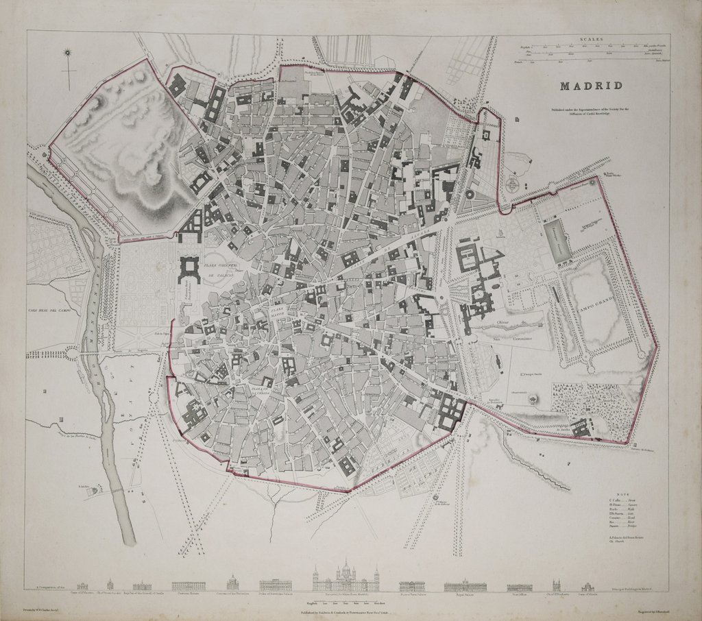
This is a top-down view of Madrid from 1833 published in Maps of the Society for the Diffusion of Useful Knowledge. Drawn by W. B. Clark, Engr. & printed by J. Henshall. Published, Baldwin & Cradock, London, 1833
Vintage Map of Madrid, date unspecified
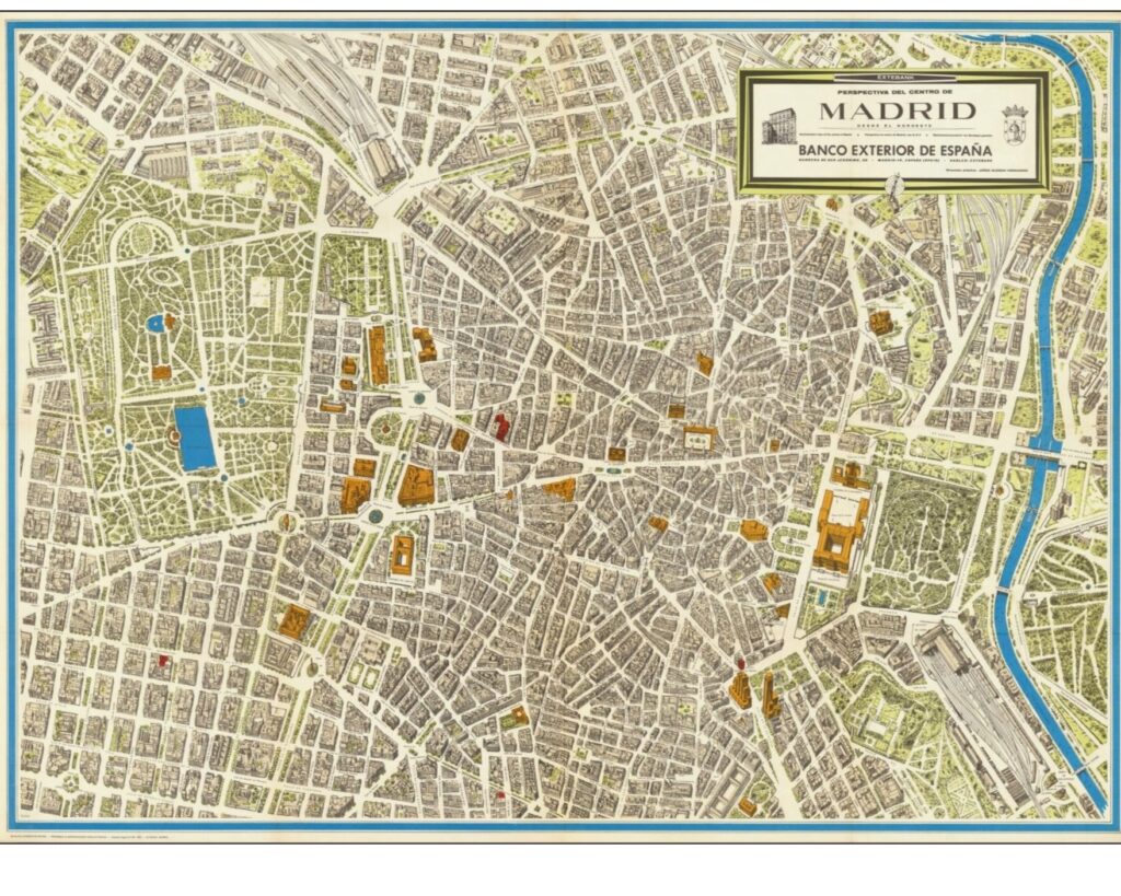
Interesting and rare map of Madrid, published for the Banco Exterior de España. This large isometric view is in the vein of Turgot, Blondel La Rougery, and Bollman. Jorge Guzman Hernandez also produced a map of Madrid.
Plano de Madrid – Francisco Coello de Portugal y Quesada, 1849
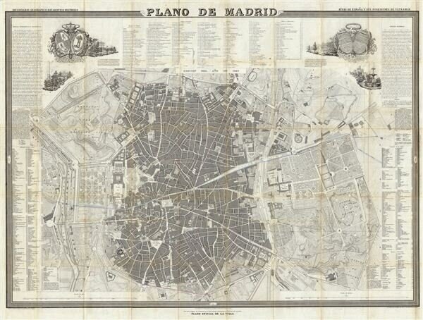
A fine example of Francisco Coello de Portugal y Quesada’s massive map of Madrid, Spain. Coello’s map is one of the finest and largest maps of Madrid to appear in the 19th century. Centered on the Puerta del Sol, this map covers the center of modern Madrid as well as the surrounding parks, farms, and […]
“Hispania” Mercator/Hondius, 1610
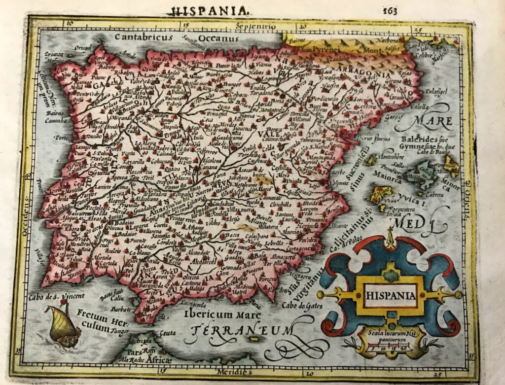
Charming hand colored miniature map of the Iberian Peninsula and the Balearic Islands with considerable detail throughout. A sailing ship is shown entering the Straits of Gibraltar and a large strapwork title cartouche further decorates the map. Latin text on verso.