
Jolliet & Marquette’s Discoveries (c.1681)
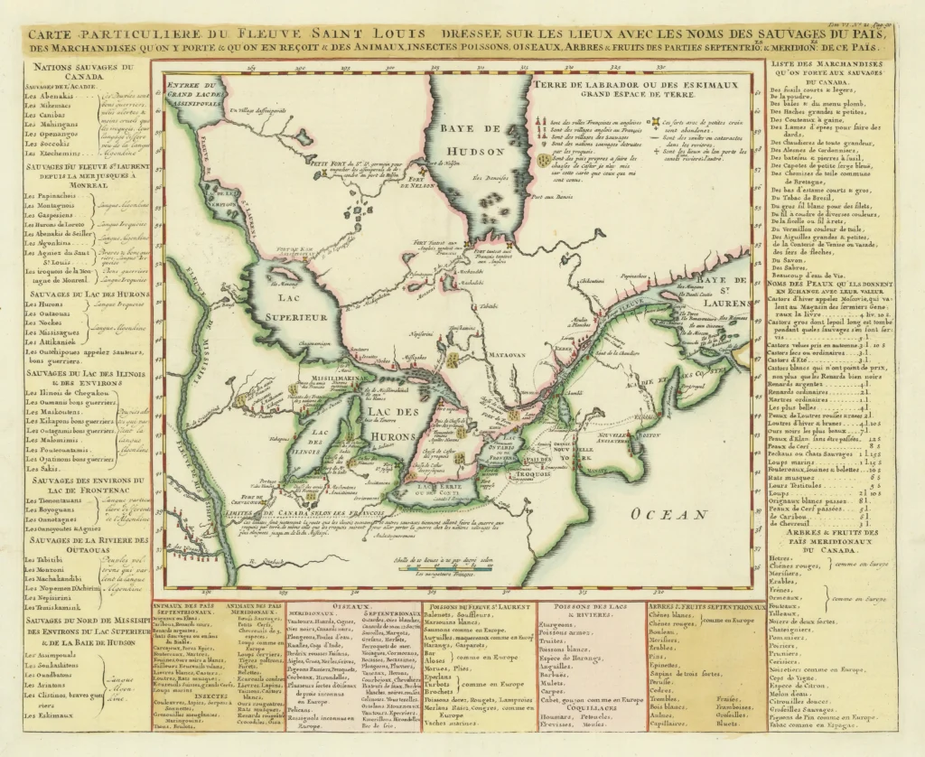
Early Map of the Great Lakes and the French Fur Trading Frontier A fine example of this important early map of Canada, the Great Lakes, and the upper Mississippi River, extending south to the Missouri and Ouabache Rivers. Based on Louis Jolliet and Jacques Marquette’s 1673 expedition, it captures the earliest French exploration of the […]
The First Map of the Mississippi River
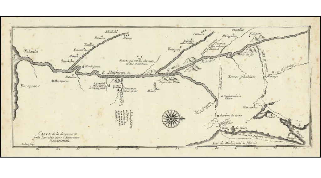
Based on the Discoveries of Jolliet and Marquette This late 19th- or early 20th-century facsimile of Melchisedech Thévenot’s 1681 map reproduces the earliest printed depiction of the Mississippi River, based on the 1673 expedition of Louis Jolliet and Father Jacques Marquette. It represents the first separate map to illustrate their journey down the Mississippi—one of […]
Novi Belgii Novaeque Angliae Nec Non Partis Virginiae Tabula – Nicholas Visscher, ca. 1652
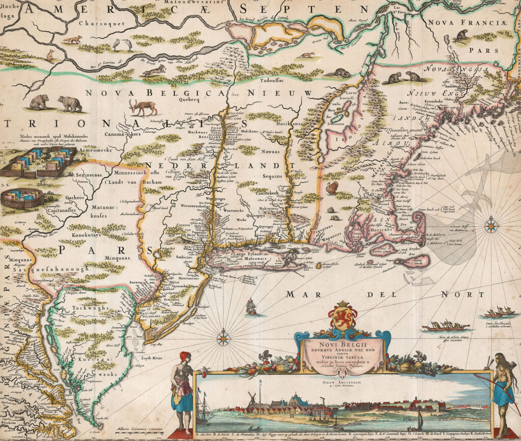
This is the scarce second state of Visscher’s New Netherlands, with Fort Kasimir included but Philadelphia still lacking. Most surviving copies are in the later third state (after 1683,) with Philadelphia added. Shortly after the first appearance of Jansson’s landmark map of New England in 1650, Nicholas Visscher issued a corrected copy, with one particular […]
Battle of Bennington, 1777
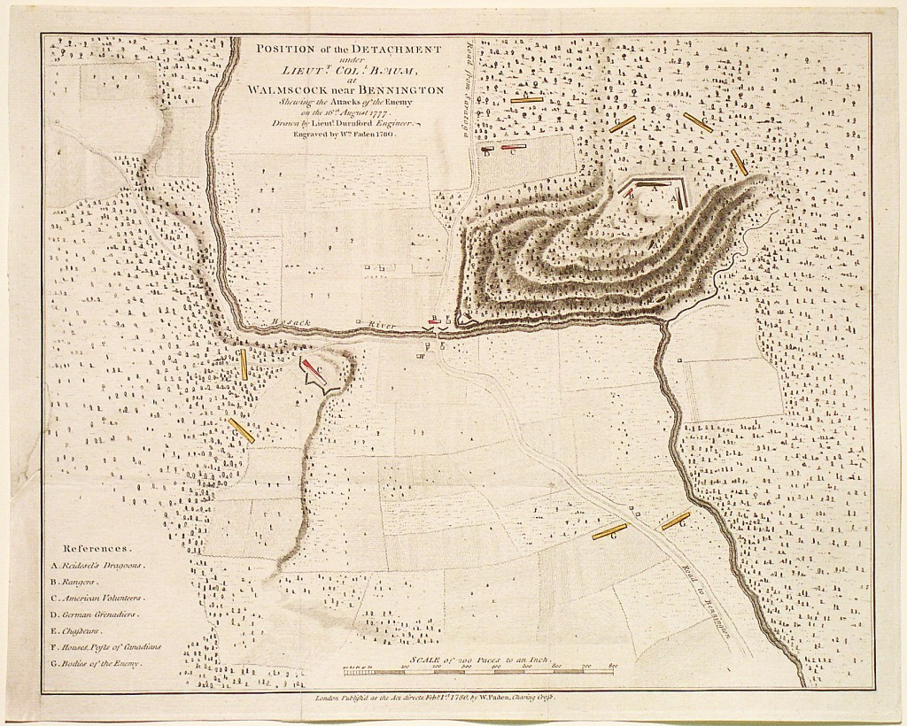
Position of the Detachment under Colonel Baum, at Waloomsack, near Bennington Shewing the Attacks of the Enemy on the 16th August 1777. Drawn by Lieut. Durnford, Engineer. Mapmaker: Faden, 1780 This is the rare separately-issued version of William Faden’s plan of the Battle of Bennington. My ancestor, Moses Nichols, was a colonel in the […]
A Map of the Most Inhabited Part of New England – Tobias Conrad Lotter, 1776
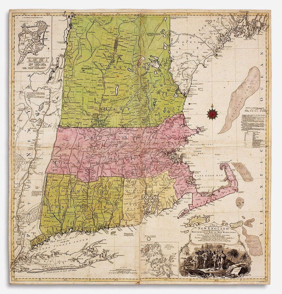
The German edition of “the first detailed large-scaled map of New England and one of the earliest printed maps of Connecticut” (Goss). “The most detailed and informative pre-revolutionary map of New England … Not really supplanted until the nineteenth century” (New England prospect, 13). The German edition follows the 1774 London edition in virtually all […]
Nova Belgica et Anglia Nova – Johannes Blaeu, 1662
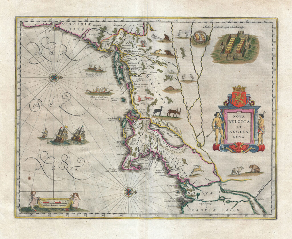
This elaborately decorated map is based on the 1614 explorations of Adrian Block, a fur trader working for the Dutch, who sailed from the north shore of Long Island to explore the southern coast of New England. William Blaeu, the premier Dutch map and globe maker of that period, published this map of New York […]
The City of New York, 1939
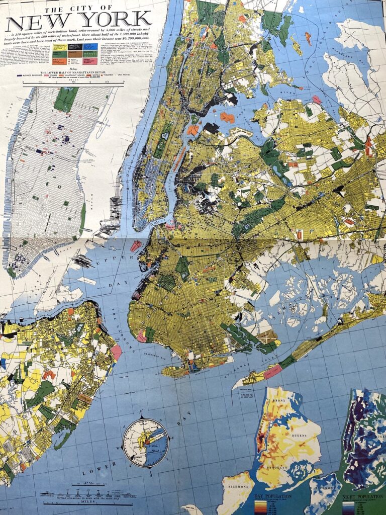
This 1939 Richard Edes Harrison map of New York City – published in conjunction with the New York World’s Fair – represents a triumph of the visual display of quantitative information. Its aesthetic impact is all the more impressive in its clear expression of municipal and demographic data, making this a map of the people […]
Bollmann’s Pictorial Map of New York – Herman Bollmann, 1963
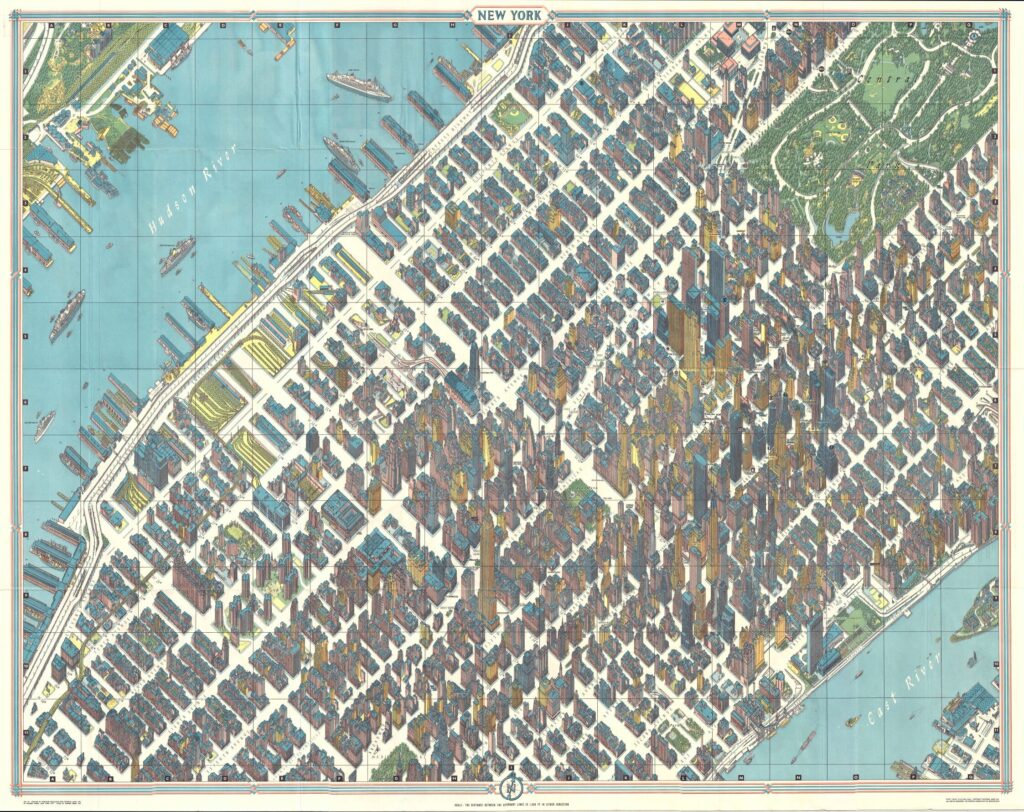
One of the greatest cartographic feats of all time, this 1963 axonometric (‘bird’s eye view’) map of New York City was the first such since 1866. The technique dates back to the 15th century, and developed in Germany into a fully flowered cartographic art form called Vogelschaukarten in Germany in the 1800s. This particular map […]
Interesting and detailed map of most of New England in 1788.
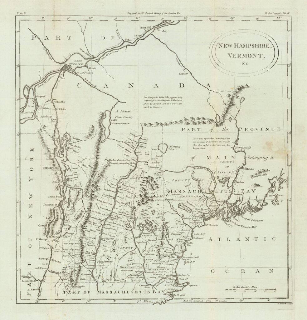
This is contemporary to when my ancestors who were Revolutionary War Patriots lived in Amherst, New Hampshire and fought in battles in Bennington, Rhode Island, and West Point during Arnold’s Treason. The map shows counties, townships, towns, forts, rivers, lakes, etc. Maine is listed as Part of the District of Main belonging to Massachusetts Bay. […]