
Grundtriss der Edlen Weitberumbten Statt Hamburg Anno 1651 – Johannes Mejer and Caspar Danckwerth, 1652
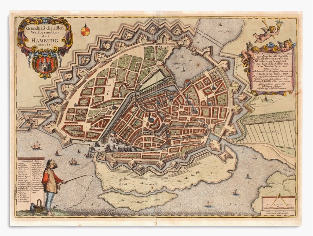
I purchased this map of Hamburg to commemorate our visit to the beautiful city of Hamburg for the International Map Collectors Society (IMCoS) Annual Symposium in October 2017.
London Underground System Map (First Edition), 1933
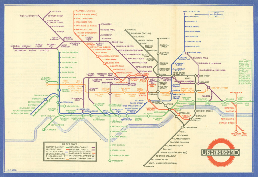
The map was designed by the 29 year-old engineer Harry Beck. Abandoning the restrictions of a geographically correct layout, the map actually constitutes a diagram of the network, showing relationships rather than distances to scale. By using only verticals, horizontals and diagonals, and adopting a clear color scheme, Beck created a design classic, both easy […]
A Plan of London and its Environs, 1840
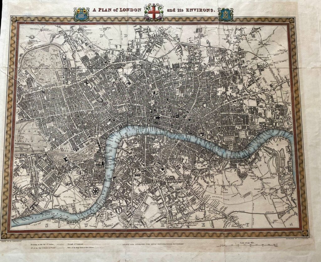
Engraved folding map from Samuel Lewis’s Topographical Dictionary. 17×21 inches sheet size; hand-colored; light soiling, few small closed tears and folds reinforced on verso.