
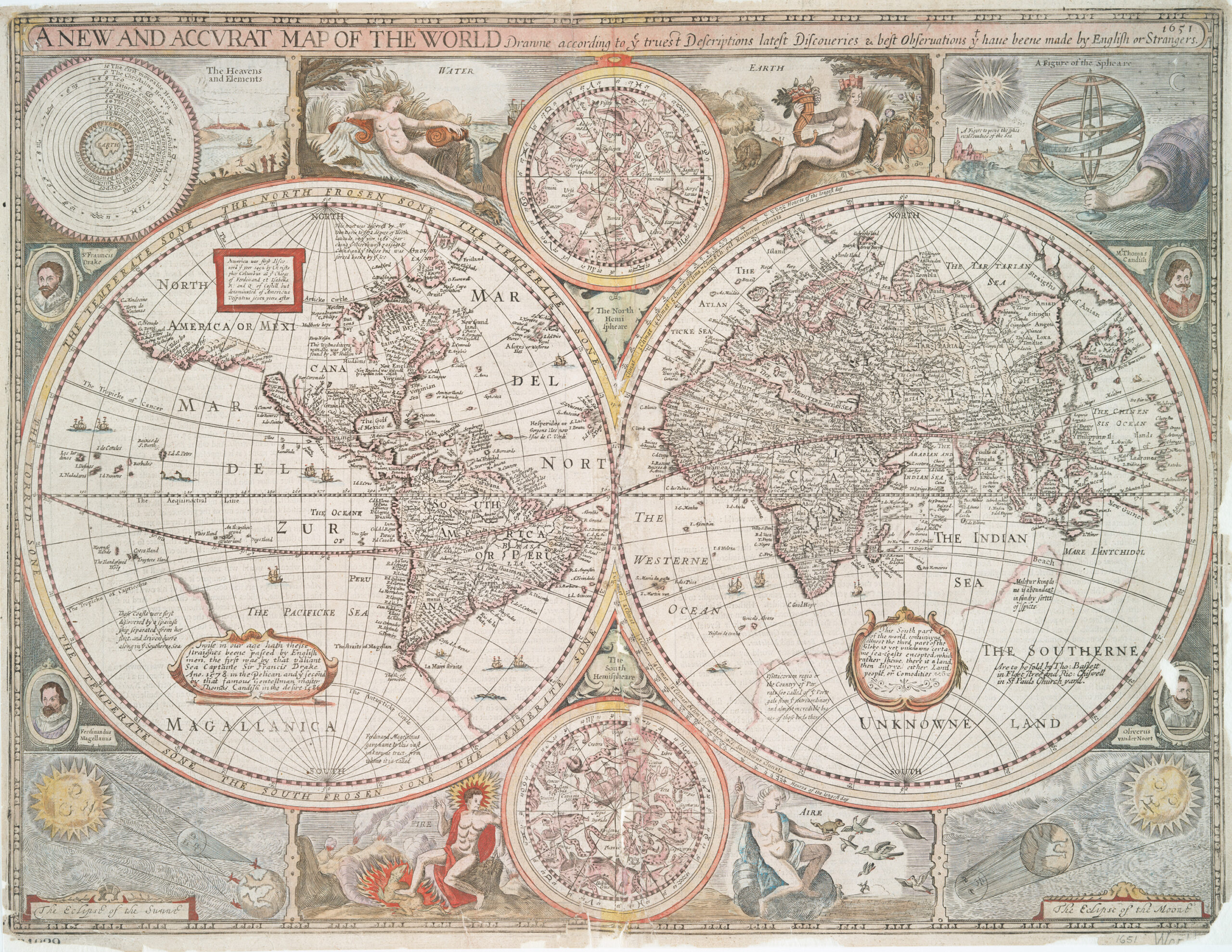
First English World Map to Show California as an Island
John Speed, 1651 (Rare Third State – Roger Rea Publisher)
From the first world atlas produced in England, this sought-after map is, in its first edition of 1627, the earliest world map in English generally available to show the famous misconception of California as an island. This example is the rare third state with the imprint of Roger Rea the Elder which proves its provenance to before the Great Fire of London in 1666. The plate is remarkable for the mass of decoration and information including allegorical figures representing the four elements – Water, Earth, Fire and “Aire” – as well as diagrams of the “Heavens and Elements,” eclipses, celestial hemispheres and portraits of the circumnavigators Drake, Cavendish, Magellan and Van Noort. John Speed’s map is a compendium of information; it shows a prominent “Southerne Unknowne Land” described as home to “The Atlantic and many other curiosities.” This is one of the best known and most important of English world maps.