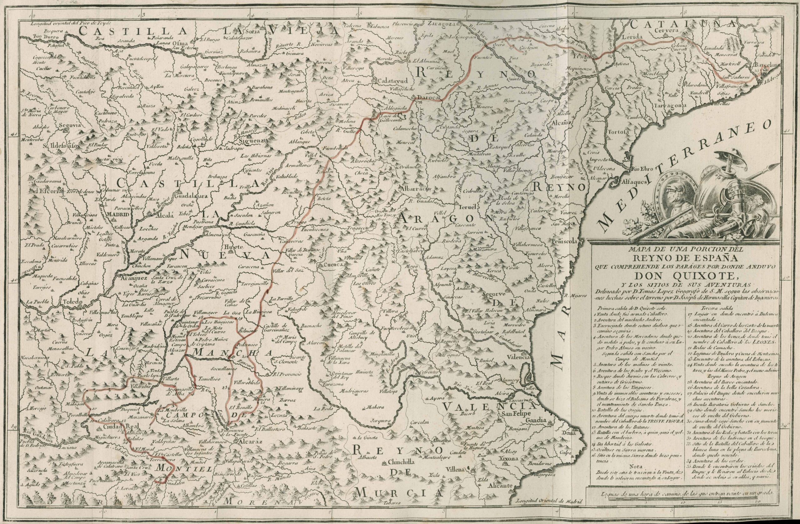
This is a map produced in 1780 upon the celebration of the publication of an anniversary edition of Don Quijote published by the Real Academia. It is the first attempt to chronicle the various adventures of Don Quijote that was included in the book. Tomas Lopez, Royal Cartographer to Charles III, worked with engineers to triangulate positions based on geological references in the fictional book. I was looking for this map as a separate item for some time, but was fortunate to find a copy of El Quijote published in 1819 that contained a copy of the map. A classic find!
