
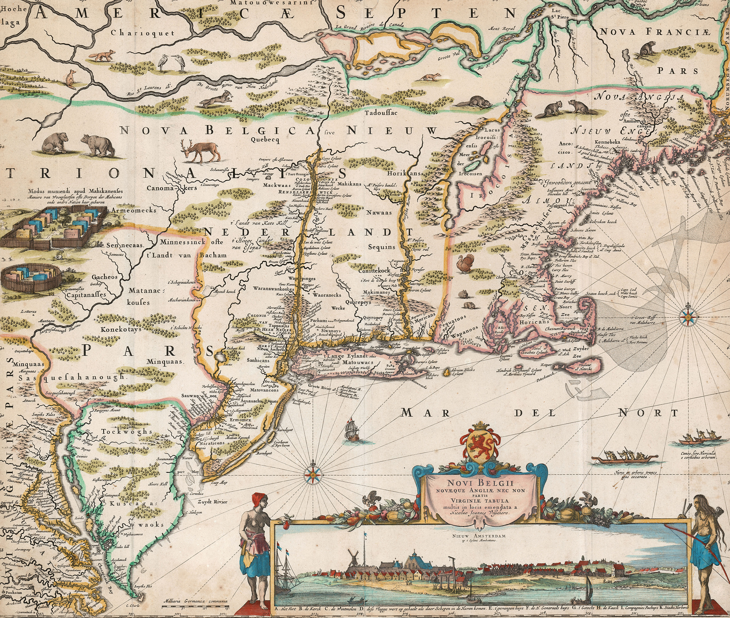
This is the scarce second state of Visscher’s New Netherlands, with Fort Kasimir included but Philadelphia still lacking. Most surviving copies are in the later third state (after 1683,) with Philadelphia added.
Shortly after the first appearance of Jansson’s landmark map of New England in 1650, Nicholas Visscher issued a corrected copy, with one particular significant addition. The Visscher map “is of extreme importance for introducing a view of New Amsterdam in the lower right” – Burden. This view is one of the earliest obtainable images of the city of New York, preceded only by the extremely rare view by Joost Hartgers, which was published in 1651, and a 1650 etched view by Johannis Blaeu which, according to Joep de Koning, is the model for the view on the Visscher map.
This early panorama of the city shows the southern section of Manhattan Island as a small wooden settlement dominated by a windmill, a Church, a hanging scaffold, pillory and fort, along with the more substantial buildings of the Director General and West India Company. With the addition of the view, Visscher created a composite map of such striking design that it became a model for numerous European cartographers for over a century. The first state of the Visscher map was separately published prior to the construction of Fort Kasimir and is known in only three examples, making this second state the earliest obtainable example of the map. De Koning redates this second edition at c.1652, where Burden had dated the map at c.1656.
References
Baynton-Williams, “Printed Maps of New England to 1780, Part II: 1670-1700,” #1655.01d (at MapForum.com). Burden, The Mapping of North America, vol. II #315, state 4. Campbell, “The Jansson-Visscher Maps of New England,” #6 (in Tooley, The Mapping of America). Stokes, The Iconography of Manhattan Island, vol. 1 pp. 147-148 and plate 7-B (describing and illustrating the first state). Background from De Koning, “From Van der Donck to Visscher,” Mercator’s World vol. 5 no. 4 (July/August 2000), pp. 28-33.