
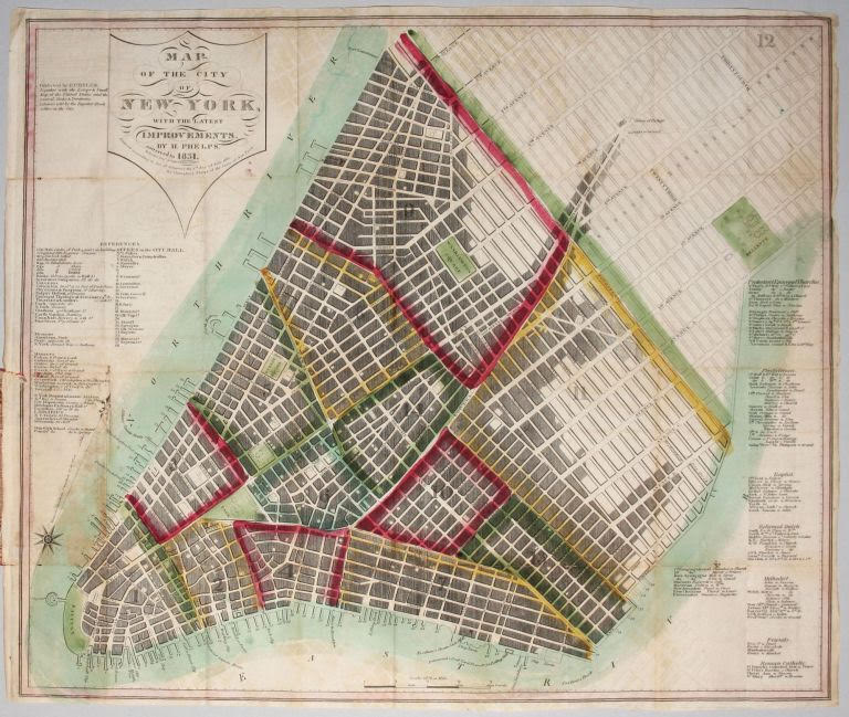
Superb Example of an Early New York City Plan
Showing the Beginnings of Development Within the Grid
New York City. PHELPS, H. [New York, 1831] Map of the City of New York, with the latest improvements….
This is a first edition of this very scarce, beautifully preserved plan published at the beginning of the most dynamic period of the city’s growth. The opening of the Erie Canal in 1825, which gave New York City access to the products of the West, was arguably the single most important factor in the city’s growth. This plan, which indicates with shading the developed parts of the city at the time, provides early evidence of the result of the Canal’s opening. For example, a similar plan by Hooker published two years earlier in 1829 shows considerably less development in the area below 14th Street in the area of today’s Greenwich Village and Lower East Side. Another indication of growth is the lists along the left side of this map enumerating expanding services, cultural institutions and markets.
Humphrey Phelps had a relatively long and active career in map publishing, both independently and with various partners. This work appears to have been his first published map; there is nothing earlier listed for him in either Rumsey or the Dictionary of Mapmakers (see below). This 1831 edition also appears to be the first edition of this plan, making this the first edition of Phelps’ first published map; no earlier edition is listed by Haskell
* Haskell, D. C. Manhattan Maps, no. 736; not in Rumsey Cartographic Collection (online site); cf. Tooley’s Revised Dictionary of Mapmakers, K-P, pp. 419-420.