
The Single Most Important American Exploration Map of the 19th Century
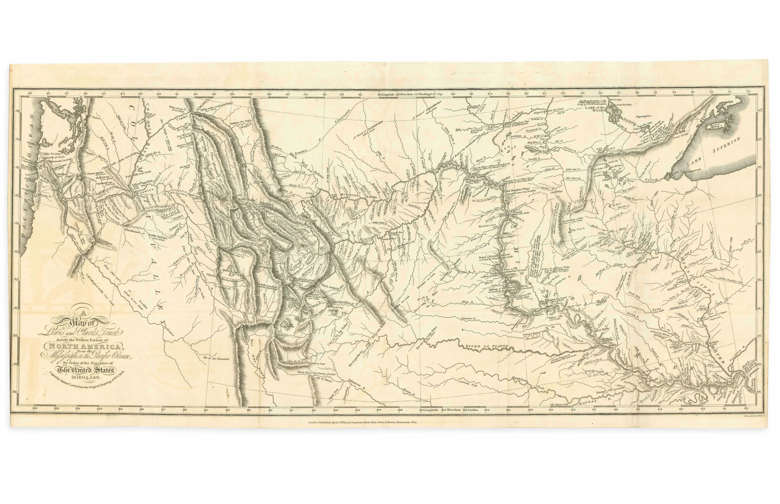
This 1815 London octavo edition of Lewis and Clark’s official expedition account includes the famed folding map of the Northwestern United States, based on William Clark’s original manuscript. It provided the first accurate depiction of the sources of the Missouri and Columbia Rivers and the Rocky Mountains, revolutionizing American geography of the West.
Described by Wheat as “a map of towering significance,” this was the first map to clearly chart the explorers’ route across North America, marking the young nation’s arrival on the global stage. Many of the place names introduced by Lewis and Clark remain part of America’s cultural landscape today.
The expedition (1804–1806) covered over 8,000 miles from the Mississippi to the Pacific, producing the first reliable geographic, ethnographic, and natural history record of the Louisiana Purchase and beyond.
This London edition, dated April 28, 1814, closely follows the Philadelphia first edition but with subtle variations in scale and nomenclature. It accompanies the complete three-volume text with five additional engraved maps, including:
- Ancient Fortification on the Missouri
- Great Falls of the Missouri
- Great Falls of the Columbia River
- Lower Falls of the Columbia River
- Mouth of the Columbia River
This map stands as a milestone in exploration and cartography, capturing the spirit and scope of Lewis and Clark’s extraordinary journey.