
Map of Spain with Decorative Cartouche – Herman Moll, c. 1755
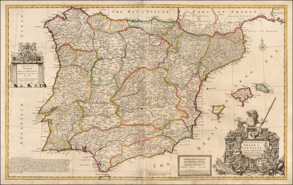
Splendid map of the whole Iberian peninsula and the Balearic islands, with an amusing note berating the publishers of other “inaccurate” maps “put out by Ignorant Pretenders.” The map includes a huge amount of information including roads, bridges and the “places where battles &c. have been fought by the English mentioned in history.” The huge […]
Syria Map – John Tallis and John Rapkin, 1851
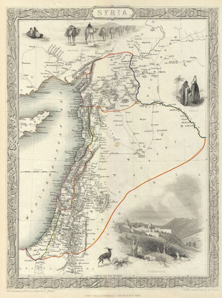
DESCRIPTION This is an appealing example of John Tallis and John Rapkin’s 1851 map of Syria. It covers from the Gulf of Iskenderun to the Dead Sea and includes the modern day Syria, Lebanon, Israel and parts of Jordan and Turkey. The map includes beautiful illustrations by H. Warren of baggage camels, Jerusalem and Arabs. […]
Detailed Map of Syria – Johannes Jansson, 1660
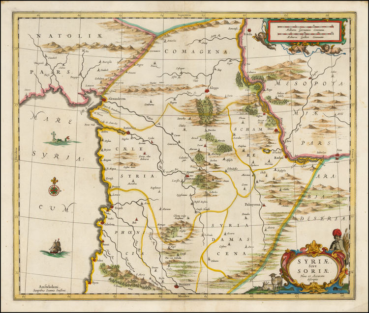
The map extends from Damascus and Sidon in the South, to Edessa, Alexandretta, and Antioch in the North. Also, Aleppo, Palmyrena, Damant, Lebanon, etc. The map extends from the Mediterranean to the Euphrates.
China Map – Gerard Mercator / Jodocus Hondius, 1606
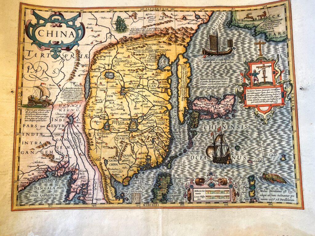
The beautifully decorated map displays much of East Asia, but China is intended as the focal point. Accordingly, the map notes many Chinese provinces, cities, and geographical features, and shows the Great Wall standing along China’s northern border. The map is noteworthy for its many errors and curiosities. Europeans knew little about Asia in the […]
Brasilia – Joan Blaeu, 1650
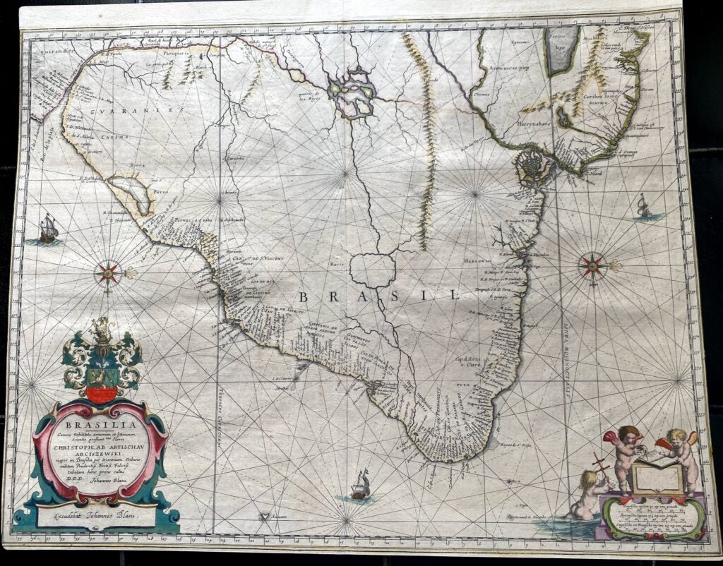
Oriented with north to the right, this map shows the eastern portion of Brazil. Includes an ornamental cartouche, and illustrations of ships and putti. “Generis nobilitate, armorium et litterarum scientia prestantmo. Heroi Christoph ab Artischau Arciszewski, nuper in Brasilia per triennium tribuno militum Prudentiss. Fortiss. Feliciss. tabulam hanc prono cultu D.D.D. Johannes Blaeu.” Appears in […]
“Hispania” Mercator/Hondius, 1610
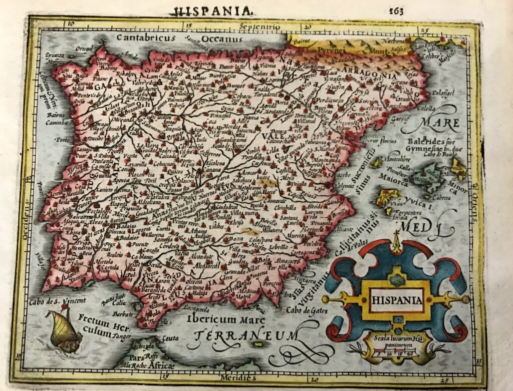
Charming hand colored miniature map of the Iberian Peninsula and the Balearic Islands with considerable detail throughout. A sailing ship is shown entering the Straits of Gibraltar and a large strapwork title cartouche further decorates the map. Latin text on verso.
Brazil Sanson, Nicolas, 1705
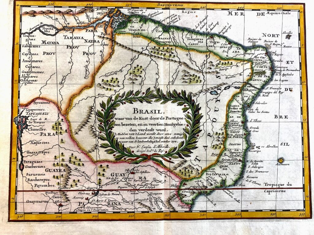
This is a reduced version of Sanson’s important map showing the Portuguese possessions in Brazil. The coastal regions were divided by the Portuguese Crown into fourteen Capitanias, or hereditary harbor offices. The holders of these grants, called donees (donatários), were responsible for their defense and development. There is also a fair amount of detail in […]