
Syria Map – John Tallis and John Rapkin, 1851
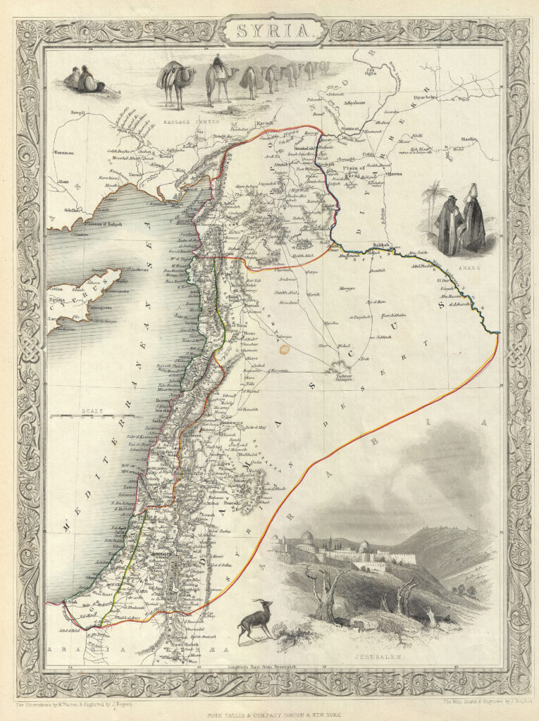
DESCRIPTION This is an appealing example of John Tallis and John Rapkin’s 1851 map of Syria. It covers from the Gulf of Iskenderun to the Dead Sea and includes the modern day Syria, Lebanon, Israel and parts of Jordan and Turkey. The map includes beautiful illustrations by H. Warren of baggage camels, Jerusalem and Arabs. […]
Detailed Map of Syria – Johannes Jansson, 1660
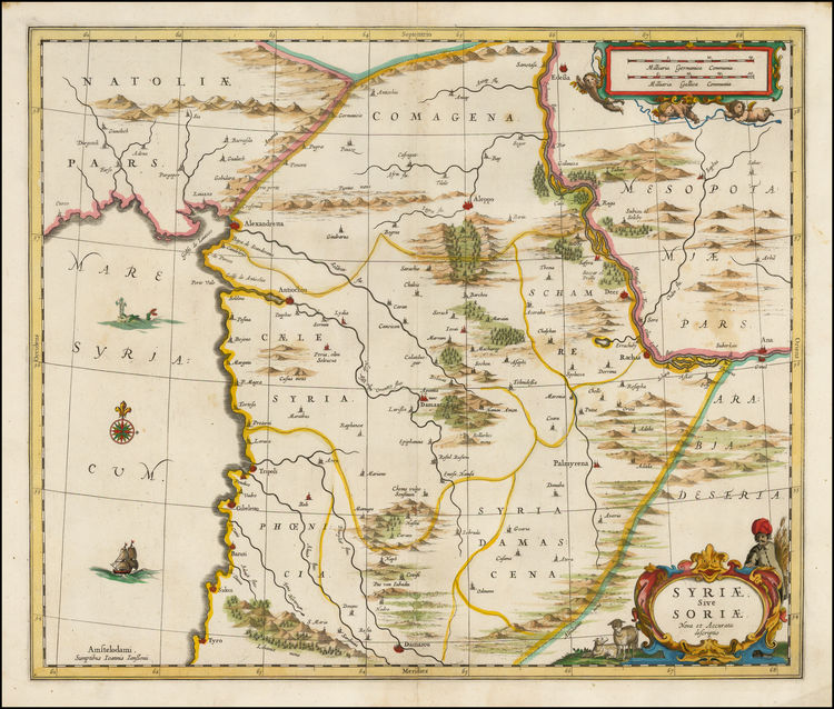
The map extends from Damascus and Sidon in the South, to Edessa, Alexandretta, and Antioch in the North. Also, Aleppo, Palmyrena, Damant, Lebanon, etc. The map extends from the Mediterranean to the Euphrates.
A beautiful hand colored map of Damascus, Syria 1575
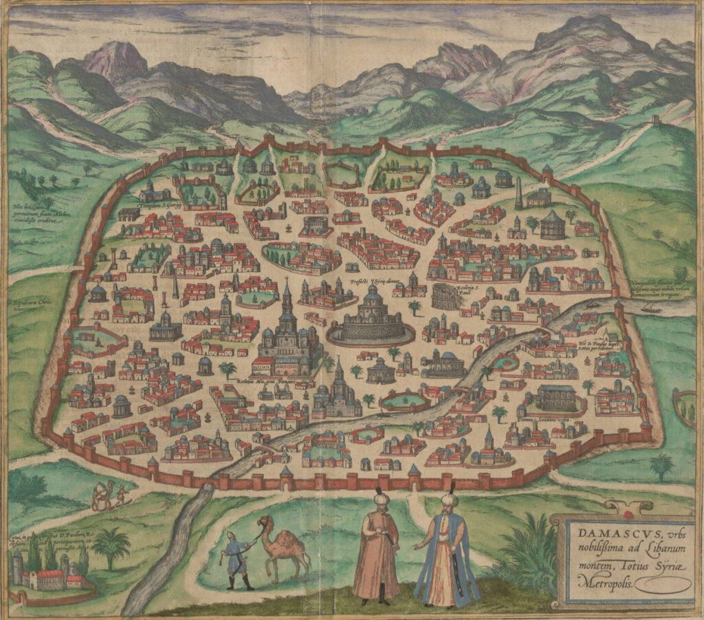
Damascus, urbs noblissima ad Libanum montem, Totius Sÿriae Metropolis This is a superb example of the 1575 view of Damascus, produced by Braun and Hogenberg for inclusion in the second volume of their Civitates Orbis Terrarum, the first dedicated city book. The beautifully engraved view, illuminated with superb original color, is one of the earliest […]